Vilnius public transport map
Problem: Create clear and handy map of Vilnius public transport.
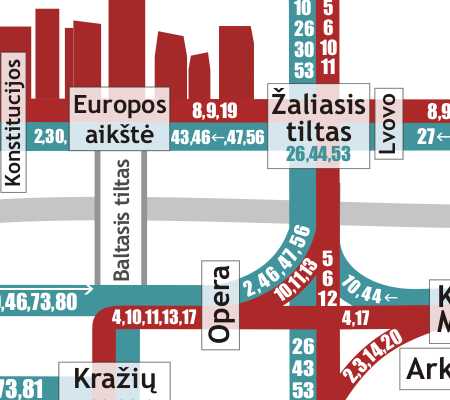
The organization of public transport in Vilnius is pretty chaotic and has plenty of routes. Many of them go through the city center and duplicate each other in many parts. Thus officials from the city government and public transport company avoid creating a clear schematic map of transport routes and use the whole map of the city as public information about the transport system.
Our transport map, printed in 2006, was the first scheme of public transport focused on the routes excluding streets network.
Now we are working on the second version of the map. Here are a few fragments of it:

The whole view
Not only transport, but important pedestrian routes are shown on the map too.

The map includes symbols of the city parts.

In contrast to official map, we show stations of very far suburbs and suburban railway
|